Maps ahead: The location of power supply connection opportunity points can now be viewed on an easy to use, dynamic, customisable online map.
We recently launched a new Mapbox-based digital mapping tool, the ‘Network Opportunity Map’ for National Grid Electricity Distribution (NGED). It gives its region’s business community, entrepreneurs, investors, local authorities and other customers, the ability to view where they can find key power supply points or opportunities in the area of Midlands, South West and Wales. The information includes Grid Supply Points (GSPs), Bulk Supply Points (BSPs), as well as primary and secondary substations.
This information is particularly useful for a range of businesses and local authorities in the area wishing to know power supply capacity levels. For example a local authority would find the dynamic map useful to see the network capacity in its geographic area for a new public EV Charge point installation. Equally, a large scale house builder, for example would find it useful to assess whether a site is viable for development, based on capacity on the network to get a new estate connected to a power supply.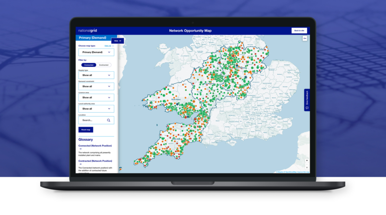
Key highlightsDynamic map functionality. A user can:
- View capacity levels by colour on the map: A user can easily see whether there is high, medium or low power capacity at any particular substation with the colour-changing coded map functionality.
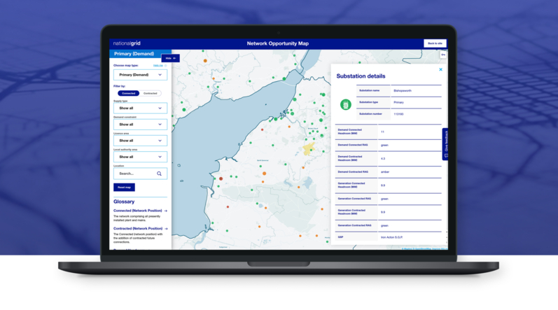
- See substation areas easily: Smart zooming and clever highlighting of geographic polygons allow users to easily see the geographic area that a substation covers.
- Click for more info: Informative pop-overs enable the user to discover detailed substation information.
- Tailor it to suit what matters to them: Multiple filter and toggle options allow users to tailor the map content to their specific need. With the choice of three different map types the user can also choose to filter the info based on: supply type, demand constraint, licence area, local authority area, location.
UX-driven features. A user can:- Watch a tutorial to learn all about the functionality of each map filter.
- Read a map glossary that aims to demystify any complex terminology.
- Access a map key to understand the meaning behind the different map markers, colours and polygon highlights.
The new Network Opportunity Map both combines and replaces ‘Network Capacity Map’ which provided information for our higher voltage networks and our EV capacity map which provided information at a distribution substation level.
You can see the live project here: National Grid | Network Opportunity MapAs the digital partner of National Grid Electricity Distribution (NGED), we support the large utility provider with delivering outstanding operational performance to its customers across its digital estate, which includes 22 websites.
National Grid Electricity Distribution is the UK's largest electricity distribution network and services nearly 8 million customers in the East and West Midlands, South West and Wales, delivering essential power to millions of homes and businesses across its regions
If you have a software development or website project you would like to talk to us about, get in touch and talk to our friendly, specialist team.


Results
Sort by:
Type:
From {{ group.title }}
Sorry, there are no results to show